8

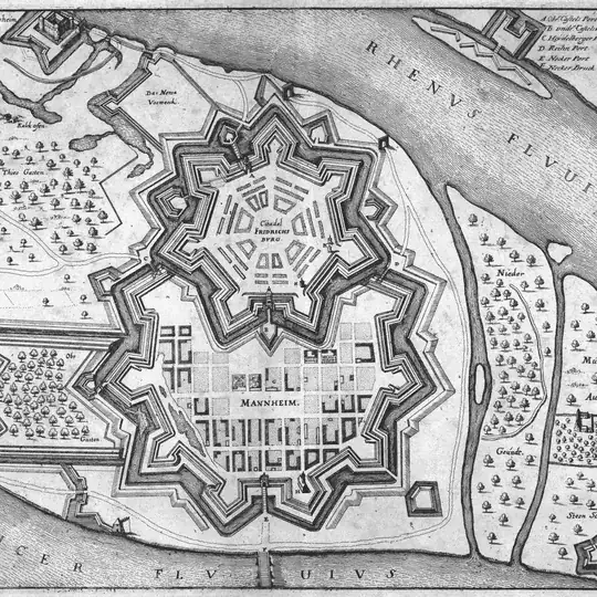
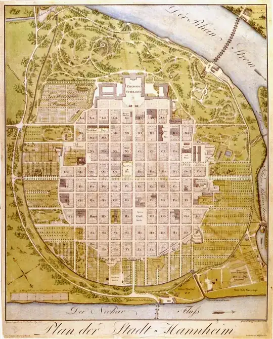
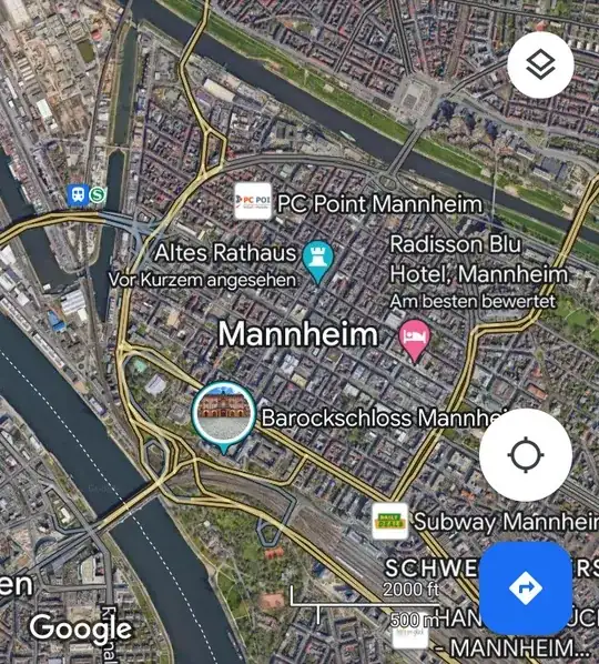
Manhattan's streets are famous for their grid layout. According to the New York Times, lines representing the vertical streets are rotated by 29° from the cardinal north/south axis.

I am looking for a place with a similar grid layout, yet oriented close to or exactly at the north-south axis. Preferably, it should be a large portion of the (itself not too small) city. The angle should approximate 90°.

Does such a place/city exist, and if so, where? Thank you in advance for reading and answering this question.

leo848
  • 197
  • 1
  • 4

9 Answers9

42

This page City Street Orientation around the World provides all the information you need, in a nifty package.

enter image description here

You'll see that in the world Bangkok and Beijing match your requirements (Rome, on the other hand, is a mess) and in the USA we have Atlanta, Buffalo, Chicago, Cleveland, Dallas and many others that are spot-on.

enter image description here

Manhattan is indeed tilted by 29 degrees.

enter image description here

Vorbis
  • 528
  • 3
  • 8
13

I believe many large cities in the US have a north/south street grid. The one I know of for sure is San Diego, CA

enter image description here

The San Diego grid pattern goes a lot further out than in my screenshot, it just wasn't clear when I zoomed out further.

Midavalo
  • 12,795
  • 7
  • 51
  • 115
13

I'd go with Salt Lake City, UT. Excluding the extension into North Salt Lake, the grid is roughly 15 x 20 miles. The layout is based on the compass grid, and the naming of the streets has an origin point on the south east corner of Temple Square.

enter image description here

Peter M
  • 15,957
  • 1
  • 54
  • 72
8

For a non-American example, Beijing has a rather rectangular grid and is very close to a 90° orientation.

Jan
  • 2,435
  • 10
  • 19
7

Most of the US and at least 800,000 square kilometers of Canada were surveyed under the Dominion Land Survey, the Public Land Survey System, and similar survey projects that divided land into (nearly) rectangular units along lines of longitude and latitude. In comparison, the area of the Dominion Land Survey alone is more than 25% larger than the largest EU country, France. I couldn't find a figure for the scope of the Public Land Survey System, but looking at the map on Wikipedia I would guess it's about 75% of the land area of the 48 contiguous states and all of Alaska, so around 7.5 million square kilometers. Between the US and Canada, these surveys cover an area that is probably about twice the size of the European Union.

Pretty much everything in these areas is aligned on the north-south axis, so basically every city will meet your criteria; only the relatively smaller organic settlements that predate the survey will sometimes deviate from the grid; these can be the central portion of an otherwise rectilinear city. Several examples of these cities are found in the existing answers to the question, but they're really only the tip of a very substantial iceberg.

phoog
  • 143,317
  • 20
  • 298
  • 485
4

Miami (and parts of Miami beach):

enter image description here

Note that I randomly cropped there, but it goes on and on...

Orlando:

enter image description here

Tampa:

enter image description here

(except a small part of downtown which is slightly angled)

Large parts of San Francisco:

enter image description here

Most of Seattle (but here again, except the most central part):

enter image description here

DC has a mostly "straight" grid, but also a number of diagonals (actually more like 30° off):

enter image description here

Las Vegas is mostly straight, except the northern part of the Strip and Downtown:

enter image description here

It's probably worth noting that many cities take advantage of that to number streets/avenues/blocks with North/South and/or East/West or NW/NE/SW/SE prefixes or suffixes (with a "point of origin" somewhere near the center). It's definitely the case in Miami, where you can find 4 "6th streets": NW, NE, SW and SE.

jcaron
  • 99,044
  • 6
  • 191
  • 378
3

As it hasn't been mentioned yet, I'll throw in a plug for Chicago's rigorous grid system, described in this article:

A recent academic study, “Urban spatial order: street network orientation, configuration, and entropy,” by Geoff Boeing, looked at the maps of 100 major world cities, and found that Chicago’s “exhibits the closest approximation of a single perfect grid.” Nowhere else have urban planners been so successful in imposing Euclidean order on natural surroundings. On a scale of 0 to 1, in which 1 is a perfect grid, Chicago scores 0.9. (The least-perfect grid is Charlotte, a Sunbelt city whose street system is more entropic than Rome or São Paulo.)

Chicago seen from space, Commander Tim Kopra / NASA

With the exception of some diagonal streets like Clark St. or Ogden Ave, the streets in Chicago run strictly along the cardinal directions:

Although there are a few exceptions (see "diagonals" below), almost all Chicago streets run either north-south or east-west. To make matters even simpler, those directions reflect actual compass directions: a "north-bound" street in Chicago really does run toward the north pole, a "west-bound" street will eventually take you to Iowa, and an "east-bound" street will always drop you in Lake Michigan.

bjmc
  • 131
  • 2
2

There's a large area around the western end of the US-Canadian border where virtually all major streets and avenues are arranged in interconnected north-south grids. It covers roughly the area between Chilliwack, West Point Grey (in Vancouver) and Bellingham. However, many highways and neighbourhood streets in the area are oriented differently.

Lower Mainland

Joooeey
  • 131
  • 3
2

I am looking for a place with a similar grid layout, yet oriented close to or exactly at the north-south axis. Preferably, it should be a large portion of the (itself not too small) city. The angle should approximate 90°.

Allthough Mannheim does not fullfill the exactly at the north-south axis (more north-east to south-west) condition, the angle is 90°.

1645 1813

Note: North is the lower right part of the 1645,1813 maps

Even today, the city center has no street names, but uses grid locations.

The address of the old city hall is: F1 5, 68159 Mannheim.


Sources:

Mark Johnson
  • 30,560
  • 3
  • 52
  • 118