6

I have to go from Mauritius MRU airport to Mahebourg, and I'd like to try walking.

Only 5 kilometers apart (even though Google Maps' crazy walking route makes it 88 kilometers)

Is it possible to:

  • Exit the airport by foot
  • Turn left and walk towards the seaside
  • Walk between the coast and the southern part of the airport to Blue Bay Link Road
  • Walk beside Blue Bay Link Road to Mahebourg

... while avoiding death by GPS?
I would prefer to go around the airport via the South, because of big roads via the North.
I don't mind small agricultural trails, as long as they can be used lawfully.

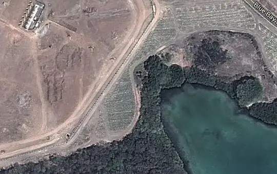
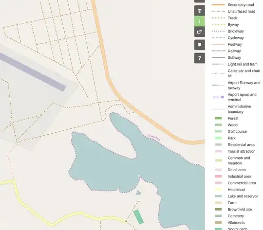
Below is one of the trickiest parts:

Mauritius MRU airport to Mahebourg

https://maps.google.com/maps?q=-20.43895,57.70185

nic
  • 9,321
  • 1
  • 43
  • 83

1 Answers1

4

Only 3 kilometers apart

You can't exit on the other side of the runways, that's quite clear so if you just take this https://goo.gl/maps/bkn67 section, it's already 3km and you are not yet on the other side of the airport. Then from the point you provide (or so) to the very outskirts of the town https://goo.gl/maps/wRIop it's another 2km. So you are looking at a 6km+ walk irregardless whether a connection exists between the two sections.

Otherwise yes http://www.openstreetmap.org/way/172314925#map=16/-20.4383/57.6912 there is a footpath and then unpaved roads where you need them. OpenStreetMap of MRU