23

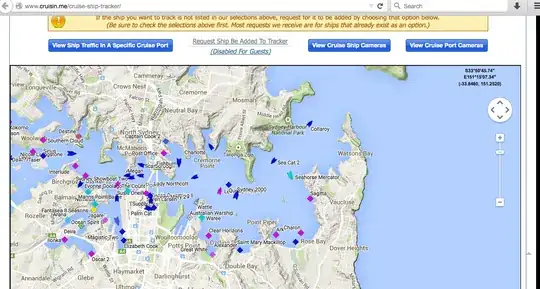
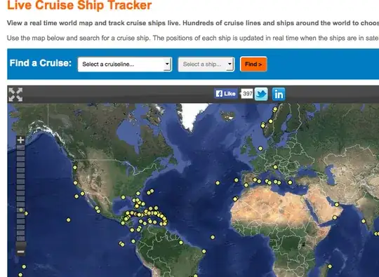
The Queen Mary 2 is currently in port in Sydney. I'd love to see it but am bedridden at present. However, to leave port it must pass the window of where I am. I'm wondering if there's a website that plots either just the QM2 position (I tried seascanner's QM2 page but sadly it's exceeded its maps API quota so isn't working), or ideally, like flightradar24 for planes, a version for cruise ships?

(And to clarify, seascanner wouldn't work as an answer, unless it has a different page that I've not found that is presently working)

Mark Mayo
  • 160,001
  • 106
  • 687
  • 1,492

2 Answers2

16

A bit more searching and I've found Vesselfinder's QM2 page.

Getting closer, I've found Crusein Me Ship Tracker, which looks promising...

enter image description here

And The Cruse Village has a Live Ship Tracker:

enter image description here

Mark Mayo
  • 160,001
  • 106
  • 687
  • 1,492
6

There's MarineTraffic, but it lists the Queen Mary 2 as currently out-of-range of its terrestrial AIS feed. They also offer satellite-base AIS feeds, but you need a paying account for that. The free feed should be sufficient to track ships while near land.

(AIS = Automatic Identification System, a VHF-based system used by ships to broadcast their position and other data to each other)