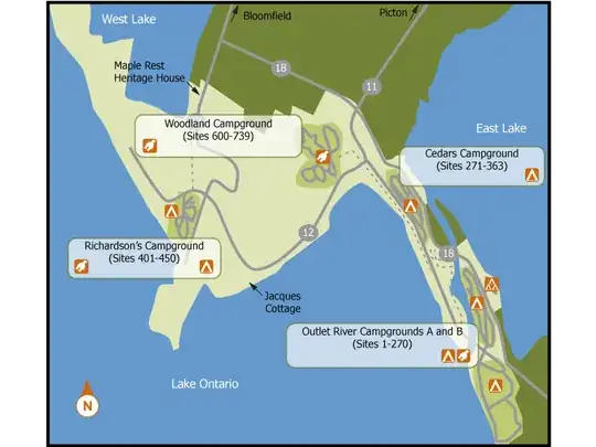
The vast majority of Ontario Provincial Parks are road-oriented. The campsites are clustered together on a little group of roads near the lake/river/beach around which the park is sited. This map of Sandbanks is typical:
The parks with backcountry are the exception: Algonquin, Killarney, and Quetico are the big ones, but you can find others on the parks website if you expand Things to Do and check Backcountry camping. I count 24 of them in all. (Non operating parks add about a hundred hits and are not a useful avenue of investigation.)
If you're looking for a park with roads right up to the campsites - that's the norm! Pick a park that's in an area that seems handy to you (probably using the website link above and zooming on a particular area of the province) then check out the entry for that site (like the Sandbanks link above.) Each park has a link to an online map for it that will show you the park roads.
Algonquin is not a typical provincial park. Don't assume the others are like it.
