15

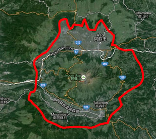
It is currently forbidden to climb within 1 kilometer of the crater of Mount Aso (largest active volcano in Japan), so I used Google Earth to find another hike giving nice views of the volcano, and found this caldera that surrounds it:

Mount Aso from ridge

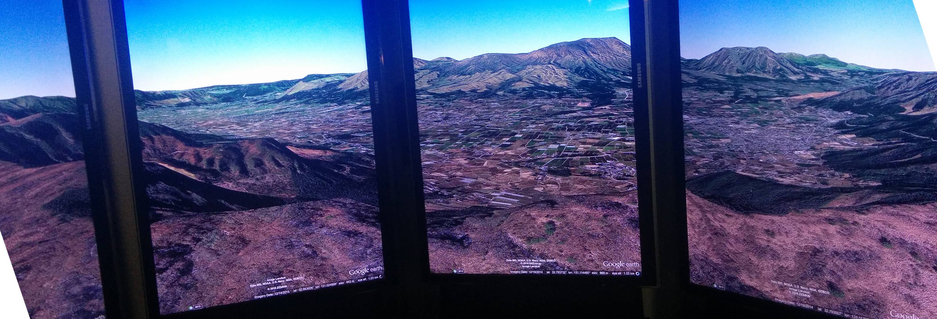
The ridge forms a somma circle with a radius of about 10 kilometers around the crater:

Mount Aso somma

QUESTION: Is it possible to walk along the edge of this ridge?
I don't want to fight my way in the jungle, so I am looking for a beaten path, at least a documented trail.

The South edge looks like the most beautiful, joining the peaks Seieizan-Onariyama-Shirogadake-Shiroyama-Takagiyama (清栄山-御成山-城ヶ岳-城山-高城山), dominating the towns of Takamori and Minamiaso (高森, 南阿蘇村) in the caldera.

nic
  • 9,321
  • 1
  • 43
  • 83

1 Answers1

1

Most if not some of the way is possible to be trekked on a semi-beaten path.

The ridge you mention actually has roads most of the way around it. If you are to go hiking, some that I recommend (although still old paved roads) would be somewhere like Sky Road / Laputa Road (Yes, named after the Studio Ghibli movie). Google Map shows it as Closed (which it just may be due to the earthquakes) however I have found it (at least until the recent earthquakes) accessible to walk most of the time (there is parking available at the top of the road).

Google Images Search - 天空ラピュタの道

From what I can tell from looking at available maps, there are hiking trails around the Southern an Eastern sides of the ridge which should be accessible (albeit checking local police / hiking information may be required as they may be closed due to the recent earthquakes). As for the rest of the ridge, not covered by roads or trails, you will find that quite a lot of the area is private farmland (Dairy and Beef cattle mostly) so use your own discretion when thinking about walking through someone elses farm.

The Wandering Coder
  • 1,312
  • 10
  • 16